Trail Walking La Roche-de-Rame - lac de l'ascension  - Photo
 gildascb
gildascb

User

© OpenStreetMap contributors
Length
Length
13.4 km
Max alt
Max alt
2448 m
Uphill gradient
Uphill gradient
827 m
Km-Effort
Km-Effort  
24 km
Min alt
Min alt
1783 m
Downhill gradient
Downhill gradient
828 m
Boucle
Boucle
Yes
Creation date :
2019-01-15 14:42:46.134
Updated on :
2021-08-12 16:17:56.921

(0 Reviews)

Walking
Walking
5h10
Difficulty : Easy

Scan this QR Code to open this trail in the SityTrail application

FREE GPS app for hiking

Logo SityTrail SityTrail

IGN / Geographical institutes

Download SityTrail from the App Store Download SityTrail from Google Play

Logo SityTrail SityTrail World

The world is yours!

Download SityTrail from the App Store Download SityTrail from Google Play Download SityTrail on Huawei AppGallery

About

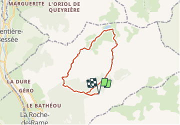
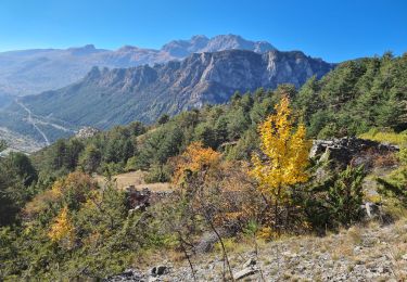
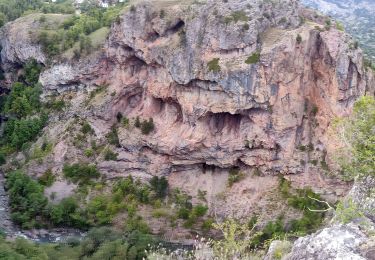
Trail Walking of 13.4 km to be discovered at Provence-Alpes-Côte d'Azur, Hautes-Alpes, La Roche-de-Rame. This trail is proposed by gildascb.

Description

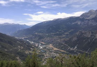
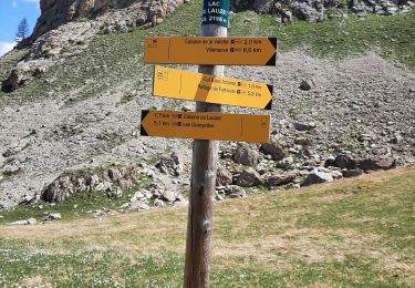
Ce circuit peut se faire depuis de nombreux endroits. Celui décrit ici part du Hameau du Lauzet au-dessus de la Roche-de-Rame. Piste d'accès d'une longueur de 10km - refaite récemment (2017 ou 2018) et accès facile, y compris pour des voitures basses.

La boucle peut se faire dans les deux sens. Pour éviter de commencer par une montée très dure, il est conseillé de prendre la boucle dans le sens des aiguilles d'une montre.

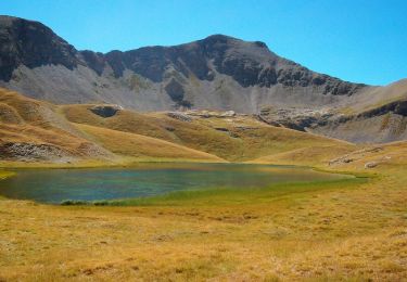
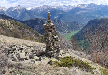
La vue depuis le col du Peyron est juste magnifique !

Elevation profile

Photos

Positioning

Country:
France
Region :
Provence-Alpes-Côte d'Azur
Department/Province :
Hautes-Alpes
Municipality :
La Roche-de-Rame
Location:
Unknown
Start:(UTM)
312023 ; 4959127 (32T) N.

Trails nearby

Trail Walking Freissinières - crête en bordure vallée Freissinieres - Photo
Walking
gildascb

Walking

Medium
(2)
Freissinières, Provence-Alpes-Côte d'Azur, Hautes-Alpes, France
14.7 km | 26 km-effort
4h 52min
Yes
Trail Walking Champcella - Gouffre de Gourfouran - Photo
Walking
CYCLOHC

Walking

Easy
(2)
Champcella, Provence-Alpes-Côte d'Azur, Hautes-Alpes, France
5.1 km | 8.1 km-effort
2h 2min
Yes
Trail Walking La Roche-de-Rame - Lac de l'Ascension - La Roche de Rame - Photo
Walking
tracegps

Walking

Difficult
(1)
La Roche-de-Rame, Provence-Alpes-Côte d'Azur, Hautes-Alpes, France
14.3 km | 25 km-effort
4h 30min
Yes
Trail Walking Freissinières - tour de fressiniere - Photo
Walking
tchoua

Walking

Medium
Freissinières, Provence-Alpes-Côte d'Azur, Hautes-Alpes, France
25 km | 43 km-effort
6h 16min
Yes
Trail Walking La Roche-de-Rame - la grande barre par cabane des aiguilles  - Photo
Walking
tchoua

Walking

Very difficult
La Roche-de-Rame, Provence-Alpes-Côte d'Azur, Hautes-Alpes, France
13.7 km | 27 km-effort
3h 34min
Yes
Trail Walking Champcella - 2020-09-10 Balade Gouffre du Gourfouran - Photo
Walking
GUIDE
holtzv

Walking

Very easy
Champcella, Provence-Alpes-Côte d'Azur, Hautes-Alpes, France
4.8 km | 7.8 km-effort
1h 14min
Yes
Trail Walking La Roche-de-Rame - Le Pic du haut Mouriare et le lac de l'Ascension - Photo
Walking
GUIDE
amiral13

Walking

Very difficult
La Roche-de-Rame, Provence-Alpes-Côte d'Azur, Hautes-Alpes, France
17.3 km | 34 km-effort
8h 20min
Yes
Trail Walking La Roche-de-Rame - 04-La Roche de Rame-lacs de l' ascencion - Photo
Walking
Maryma

Walking

Medium
La Roche-de-Rame, Provence-Alpes-Côte d'Azur, Hautes-Alpes, France
15.8 km | 28 km-effort
5h 23min
No
Trail Walking Saint-Crépin - lac du lauzet - Photo
Walking
gibello

Walking

Medium
Saint-Crépin, Provence-Alpes-Côte d'Azur, Hautes-Alpes, France
11.3 km | 21 km-effort
5h 1min
Yes


Close
My subscriptions